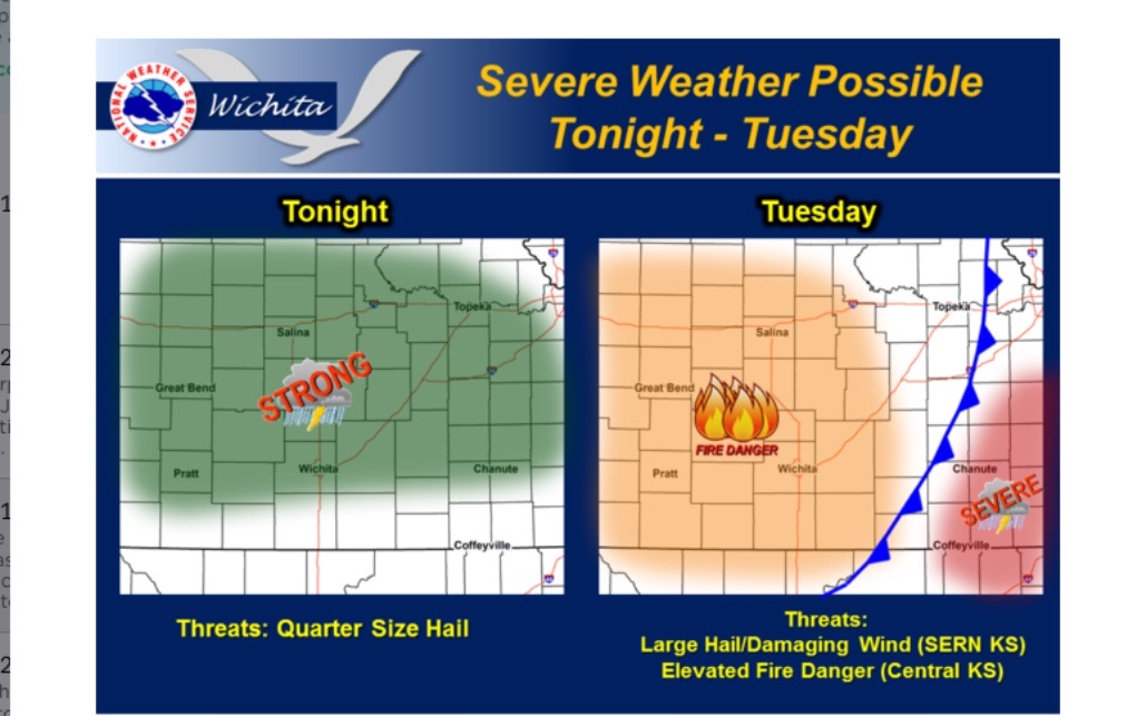
Though a widespread outbreak isn’t anticipated, the first severe weather of the spring is possible Monday night into early Tuesday.
According to the National Weather Service, scattered strong to marginally severe thunderstorms are possible Monday night across a large portion of the area. The main threat will be hail up to quarter size.
A few severe storms may develop over far Southeastern Kansas Tuesday Afternoon, before rapidly moving east into Missouri. The main threats from any storms that develop will be large hail and damaging winds.
In addition, grassland fire danger may become critical Tuesday Afternoon across Central and South Central Kansas, with gusty westerly winds occurring behind a pacific cold front passage.
High temperatures will be in the 60 and 70s for the first part of the week, before a cold front arrives Thursday to cool things off. There is a slight chance for light snow late Thursday, and by Friday highs in the lower 50s are expected.


