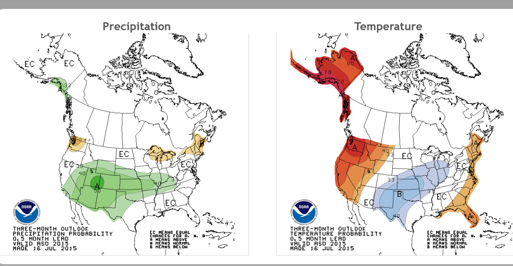
Federal meteorologists say the current El Nino is already the second strongest on record for this time of year and could be one of the most potent weather changers of the past 65 years.
The National Oceanic Atmospheric Administration recorded unusual warmth in the Pacific Ocean in the last three months. El Nino is a heating of the equatorial Pacific that changes weather worldwide, mostly affecting the United States in winter.
NOAA’s Mike Halpert said Thursday the current El Nino likely will rival past super El Ninos in 1997-1998, 1982-83 and 1972-73.
El Nino usually brings heavy winter rain in California, and much of the southern and eastern U.S. Halpert said that’s no guarantee and even past super El Ninos haven’t delivered the rain that California now needs.
Kansas State Climatologist Mary Knapp tells KSAL News signs point to a wetter than normal fall and winter in Kansas. She says that it’s not just El Nino, but that several global things that factor into the outlook. Knapp adds that not only is it expected to be wetter than normal, but also cooler as well.
Knapp notes that the cooler, wetter conditions are not expected evenly across the state. With a set-up like this, the southern part of the state typically tends to be a little wetter but quite so cool, while the northern part typically tends to be cooler, but not as wet.


