It seems the groundhog who predicted six more weeks of winter might me right.
After a mild couple of days, arctic air and snow has moved back into the area to start the week. By late Monday into Tuesday, there is a good chance for accumulating snow.
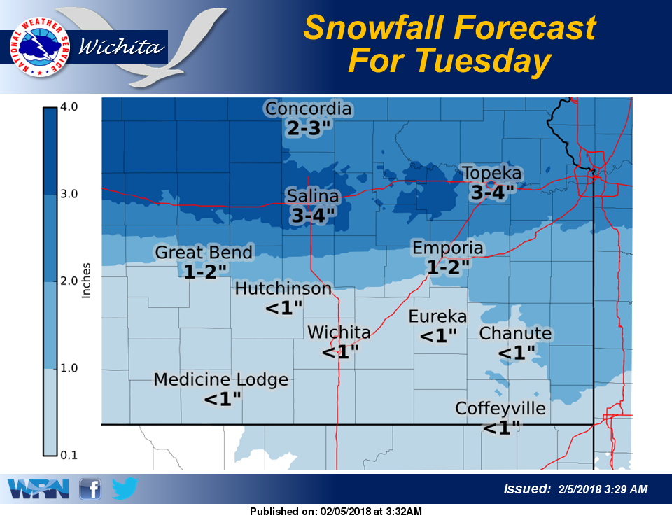
According to the National Weather Service, a winter storm will bring a round of snow to portions of the area late Monday night into Tuesday evening.
The highest snow accumulations are expected across northern Kansas, with to 2-4 inches are possible. Further south, light snow may accumulate to an inch or less with a small chance for a light wintry mix across southeast Kansas.


