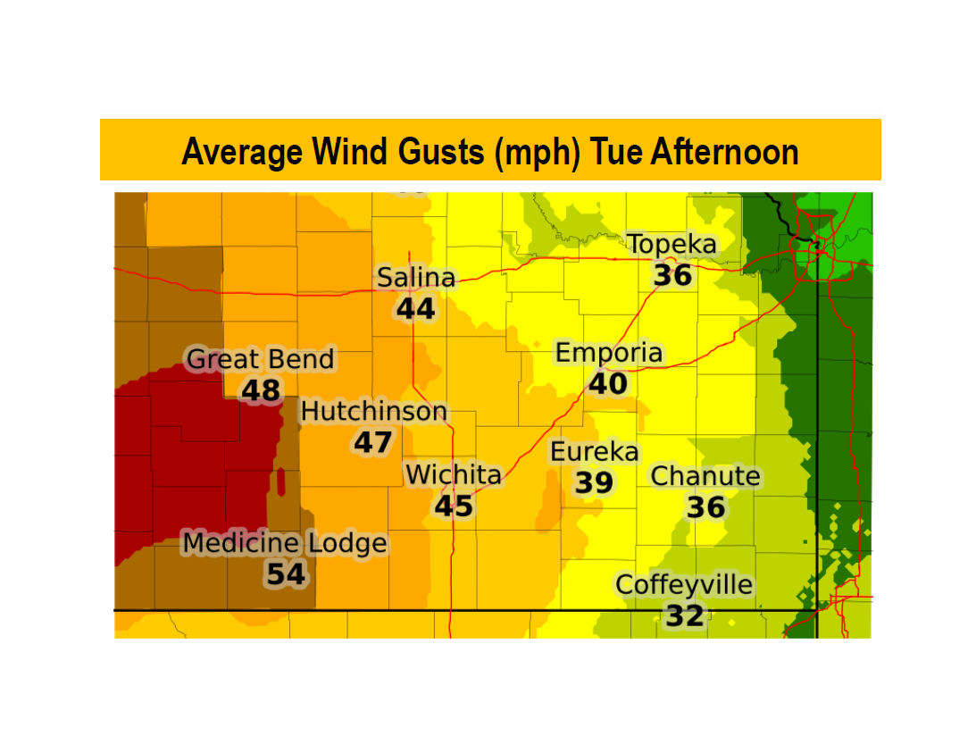
Officials are hoping for the best, but prepared for the worst on Tuesday. Weather conditions will make for extreme to catastrophic grassland fire danger in some areas of Kansas.
According to the National Weather Service, strong northwest wind of 35 to 45 mph, with gusts to around 50 mph at times, are expected during the day on Tuesday. The strong wind will result in extreme to catastrophic grassland fire danger, especially across central and south central Kansas.
The strong wind will develop in the wake of a cold front. The highest speeds are expected during the late morning and early afternoon hours.
Extreme to catastrophic fire danger is expected from 7am to 7pm on Tuesday for all of central and south central Kansas, and a portion of southeast Kansas. A very high fire danger exists in other areas across southeast Kansas.
IMPACTS:
•Strong winds may make driving difficult, especially in high profile vehicles.
•Some areas may experience blowing dust and reduced visibilities.
•Unsecured items may blow around resulting in property damage.
•Winds may be strong enough to damage utility poles, resulting in power outages.
•Any fires that develop will be difficult or impossible to control.
•Outdoor burning should be avoided.


