Following several weeks tracking fires and tracing smoke throughout western and southeastern United States, dozens of government scientists returned to their respective homes and offices from Salina, toting computers crammed with data.
They will reflect on measurements of microscopic particles, plot their movements through the atmosphere, and endeavor to make life safer and healthier for all.
Improvements to weather forecasting might occur as well.
“We know in general how those things work, but the specifics that we want to understand better are the environmental impacts of burning,” said James Crawford, senior research scientist at the NASA Langley Research Center, Hampton, Va.
He was among the key figures in FIREX-AQ conducted by NASA and NOAA – National Aeronautics and Space Administration and National Oceanic and Atmospheric Administration.
“The genesis of this project is more focused on the chemistry of smoke and the health impacts of smoke,” he said.
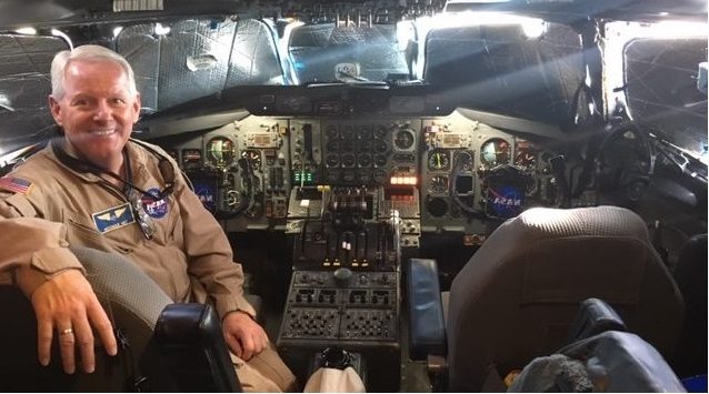
A team of 200, which included graduate students, spent 3 1/2 weeks based in Boise, Idaho, tracking western wildfires, in a big DC-8 jetliner, transformed into a flying laboratory.
The group, reduced to 100, then moved to Salina Regional Airport Aug. 20, to focus on agriculture fires, and prescribed burns, mostly targeting the southeastern U.S., until Sept. 5.
“We were able to sample 85 individual fires from Florida to Kansas and from southern Nebraska into Illinois, some small crop fires and grasslands in the Mississippi River Valley, Alabama, Georgia and Florida,” Crawford said.
The “unconnected systems” were studied by land, air and space to “determine how fire and smoke affect people, places and the environment,” according to promotional materials from NASA and NOAA.
“We were also spending a lot of time consulting these ag burns to determine what crop was being burned,” he said. “We are excited to look at the diversity, and see what is common in the different fires. We studied crop types and fuel types, and the burning and clearing of timber. It was pleasing.”
There was enough burning through the summer that the fires showed up on satellite, Crawford said, and the smoke from several fires integrated.
“This is part of a golden era of global views of our home planet in a way we’ve never had before,” said Jack Dibb, of the NASA Airborne Science Program, during the FIREX-AQ open house Aug. 20 in Salina Regional Airport’s Hangar 600.
“We’re looking at whole continents and regions,” he said. “There are things happening in the smoke.”
The project is “not just chemistry,” Crawford said, “but how smoke interacts with sunlight to affect temperatures, both at the altitude of the smoke and at Earth’s surface.”
The data will help scientists better understand the weather impacts of smoke, he said, also the chemical makeup of smoke.
“We’re learning from history and expanding on the ability to inform people,” Crawford said. Crop and pasture burning are a concern in Kansas, said Kristen Chaffin, of Salina, a natural resource specialist for the Natural Resources Conservation Service.
She’s looking forward to more information that will be gleaned from this summer’s FireX-AQ data collection and interpretation.
Prescribed burning is a common tool. She said it’s used every three to five years in the Flint Hills region.
“There have been smoke concerns,” Chaffin said. “You have to look at weather factors, roads, oil rigs, towers, power lines, and train on specific techniques to conduct burns more efficiently.”
Another group of scientists will return to Salina next summer, flying the ER-2 High-Altitude Airborne Science Aircraft.
Crawford will be headed in a different direction.
“I will be off to Asia to look at some of the most polluted air in the world,” he said. “They’re choking on this stuff. Nobody wants clean air more than they do.”


