Saline County Emergency Management is urging everyone to beware of potential hazardous weather conditions this week, including extreme fire danger, very strong wind, and potential winter weather impacts.
Fire Weather Concerns Monday & Tuesday
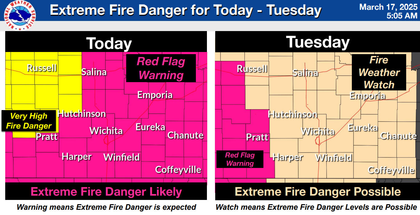
The National Weather Service has issued a Red Flag Warning for south-central and southeastern Kansas today, with Extreme Fire Danger likely on Tuesday. High winds and low humidity create conditions where fires can start easily and spread rapidly.
Monday: Very high fire danger, with wind gusts reaching 35-40 mph.
Tuesday: Extreme fire danger, with wind gusts between 40-45 mph.
Any fires that develop will be difficult to control.
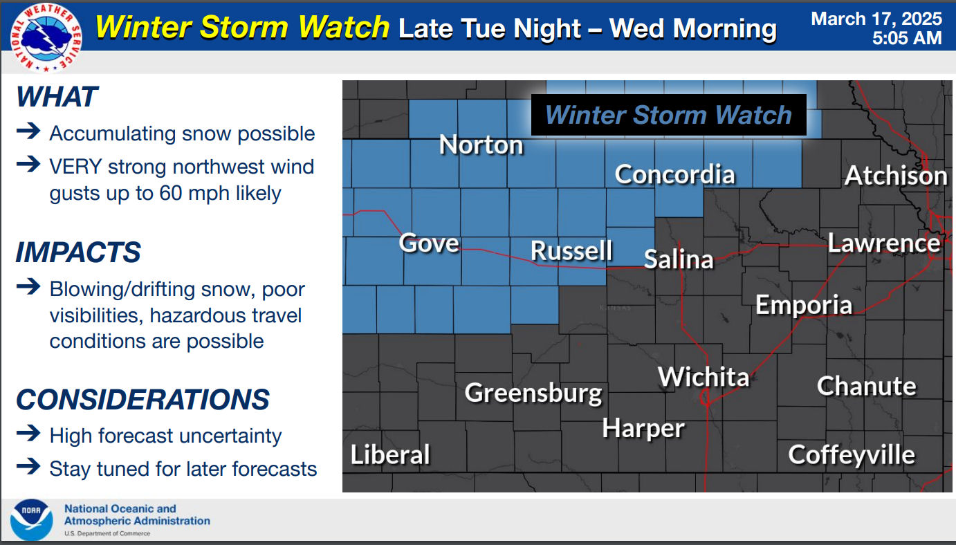
High Winds and Winter Storm Watch Tuesday Night to Wednesday
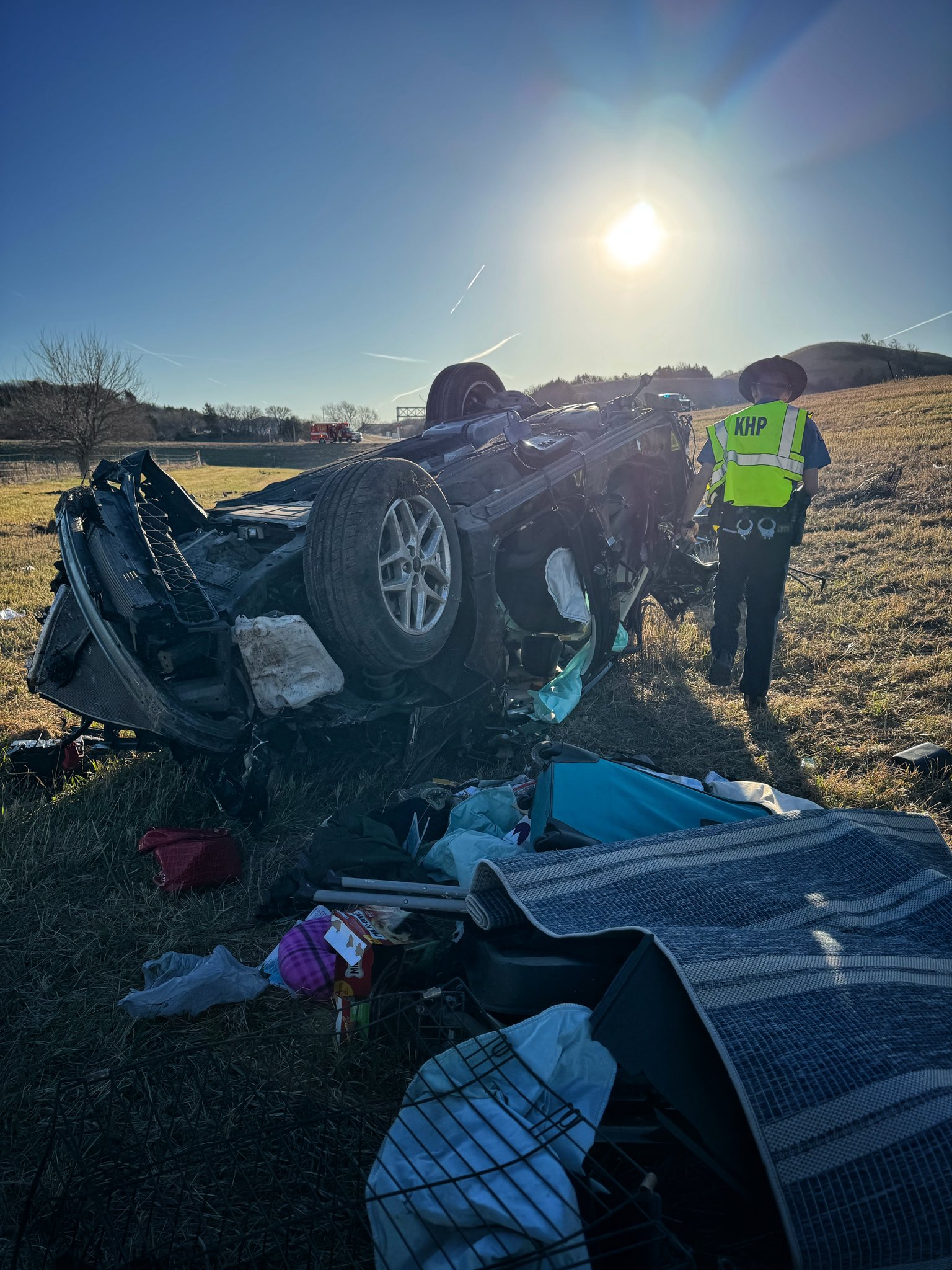
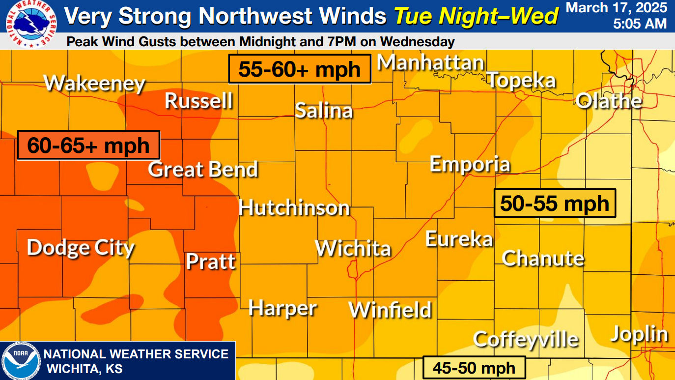
A High Wind Watch is in effect for all of central and south-central Kansas late Tuesday night into Wednesday. Winds could gust 60-65 mph, leading to dangerous travel conditions.
Hazards: Blowing dust, downed power lines, and difficult driving conditions.
Timing: Peak wind gusts expected from midnight Tuesday through 7 PM Wednesday.
Additionally, a Winter Storm Watch is in place for late Tuesday night into Wednesday morning. While snowfall amounts are uncertain, accumulating snow combined with strong winds could create whiteout conditions and hazardous travel.