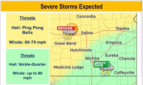
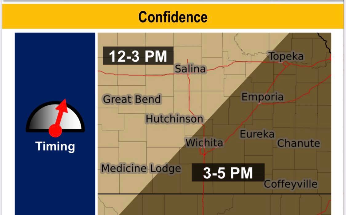
Severe storms expected to develop Sunday afternoon in Central Kansas, and will progress east into the evening and overnight.
According to the National Weather Service, areas of showers and thunderstorms will develop this afternoon and continue into the overnight. Severe thunderstorms with very heavy rain are likely with this activity
Ping pong ball sized hail is possible early, but it will transition to a more of a wind and heavy rain/flooding threat during the evening and overnight.
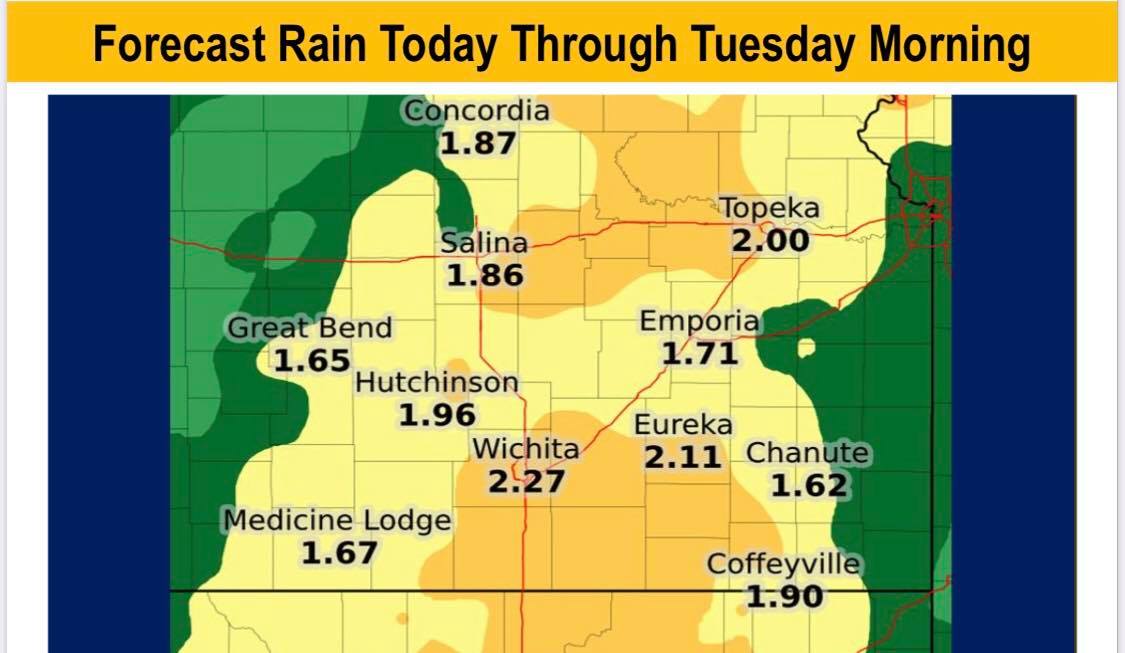
Possible rainfall from Sunday through Tuesday morning is likely to come in thunderstorm activity with very heavy rain. Localized flooding
is expected. Overnight Sunday and overnight Monday are the most likely times for very heavy rain and flooding.
A flash flood watch is in effect for the entire area through Monday evening.


