After a record setting Monday, central Kansas can see potentially another round of severe weather overnight Tuesday in to early Wednesday.
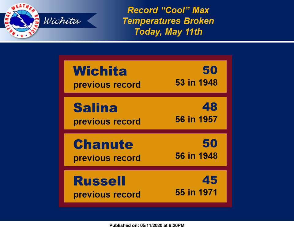
The National Weather Service says that Monday had record cold in Salina. Monday’s high topped at just 48 degrees–a record cool max temperature for May 11 in Salina.
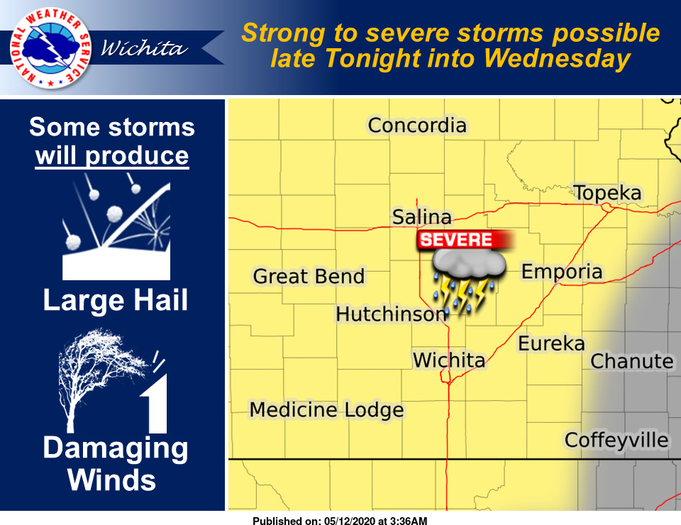
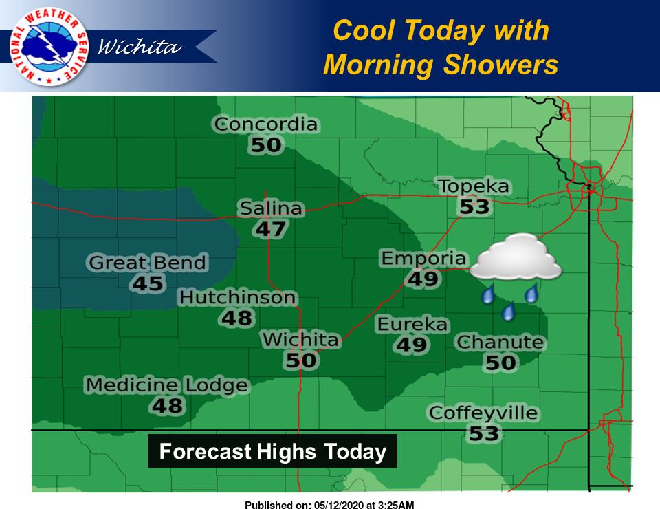
Tuesday could be another day of record breaking cold in central Kansas, however, there still is a risk for severe weather in much of the state of Kansas. While Tuesday’s high is still much cooler than normal for the middle of May with temperatures only in the upper 40s for Salina, late night storms with the potential for large hail and damaging winds are possible in the western two-thirds of Kansas beginning Tuesday night and lasting in to the early morning hours Wednesday.
Tuesday night starts an active weather pattern in Kansas where parts of the state could see daily rounds of storms or even severe weather for the next several days. For Salina, the National Weather Service says that area has a chance of storms for five days in-a-row until this coming Sunday.
Highs, however, do begin to rebound over the coarse of this week, as Wednesday’s high looks to be in the mid 60s, with mid to upper 70s highs for both Thursday and Friday in central Kansas.
- Record cold on Monday, May 11, 2020
- Cooler than normal highs for Tuesday
- Severe weather Tuesday night


