If your home has been damaged by Wednesday night’s storms and you are in need of volunteer assistance please call Saline County Emergency Management at 785-826-6511. The Red Cross is mobilizing to help.
_ _ _
Saline County is asking people to send photos of storm damage to [email protected] and be sure to include the nearest intersection or their address. It will help them assess damage, direct clean up efforts, and make a good case for state funding.
_ _ _
When the sun comes up Thursday morning Salina will have a chance to better survey damage left from a couple of rounds of storms which rolled through the area Wednesday night. The storms prompted the Saline County Commission to issue a verbal state of disaster emergency proclamation for Saline County.
A couple of rounds of severe weather dropped heavy rain, produced damaging wind. When the first storm came through, at around 7:15, damaging wind was clocked at 74 MPH at the Salina Regional Airport. The second round of storms brought even stronger wind. Just before 9:30 damaging wind of 95 MPH was clocked at the Townsite Building downtown on the roof of KSAL Radio.
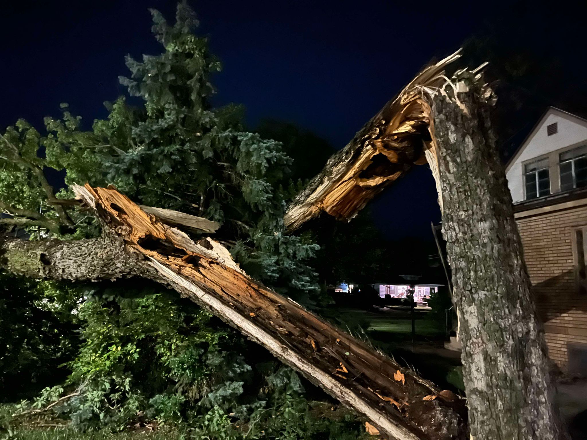
Powerlines, trees, and and large branches were brought down in some neighborhoods across town, There were initially some power outages. Evergy reported major wind damage was impacting customers in the Salina, Topeka, Lawrence and Kansas City areas. Nearly 110,000 customers without power. Crews immediately began efforts to get it restored.
The second round of storms prompted a single-vehicle crash on Interstate 135 near Salina. According to the Kansas Highway Patrol, at 9:25 wind blew a semi and trailer onto its side. A passenger in the truck was transported to Salina Regional Health Center to be treated for possible injuries. The crash happened at milepost 93.6, at the I 135 / K 140 junction.
A total of about .75 inches of rain fell as the storms rolled through.
The storms did provide a break from the heat. The high temperature in Salina on Wednesday was 104 degrees. It was still at 100 degrees when the first storms arrived, and quickly fell into the upper 70s.
Saline County is asking people to send photos of storm damage to [email protected] and be sure to include the nearest intersection or their address. It will help them assess damage, direct clean up efforts, and make a good case for state funding.
_ _ _
ORIGINAL: A couple of rounds of severe weather dropped heavy rain, produced damaging wind, and dropped large hail in some areas early Wednesday evening into the nighttime hours. .
Severe storms initially fired by early evening then a second round fired later in the night.
In Salina, a 95 MPH wind gust was clocked on the roof of KSAL Radio. There is tree and limb damage across town, and power outages. There were no reports of hail in the Salina area.
There was hail reported in northern Kansas. Hail of 1.75 inches fell in the Beloit area.
The rain did provide a brief break from the heat, but it will be back Thursday with an excessive heat warning back in effect through the evening hours.
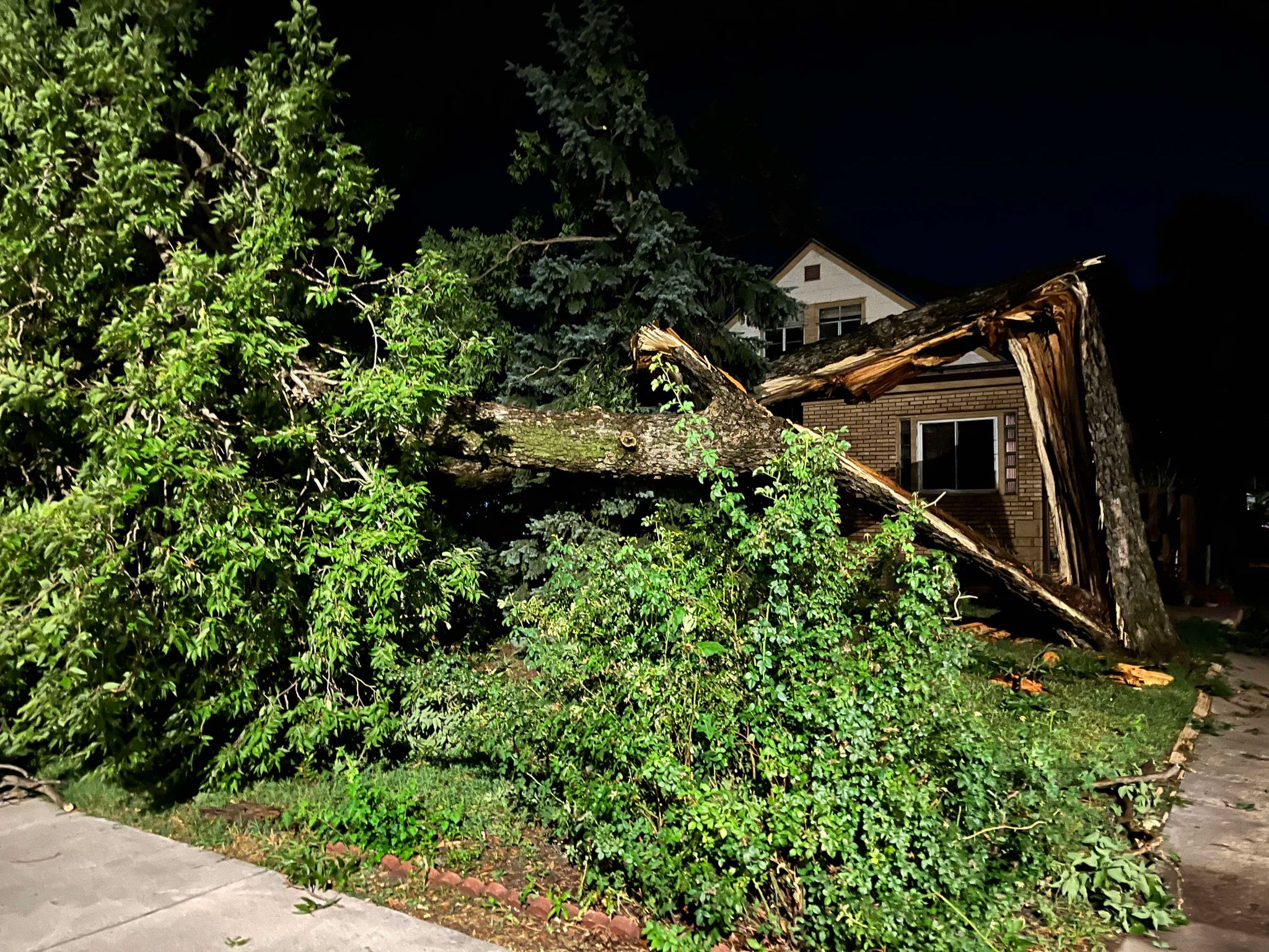
A large tree down in the 900 block of Iron – Photo by Todd Pittenger
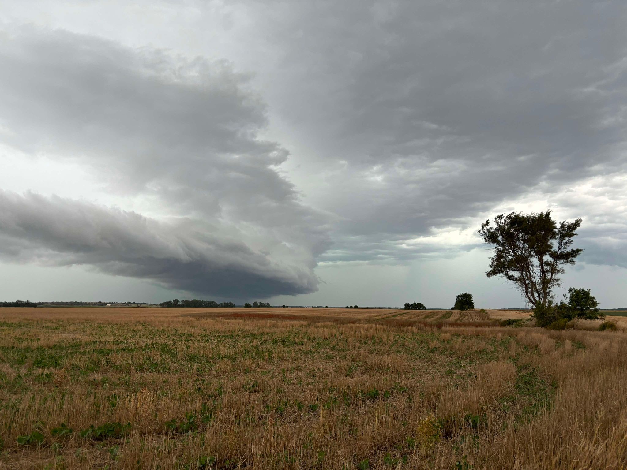
A shelf cloud NW of Salina. Photo by Tanner Colvin.
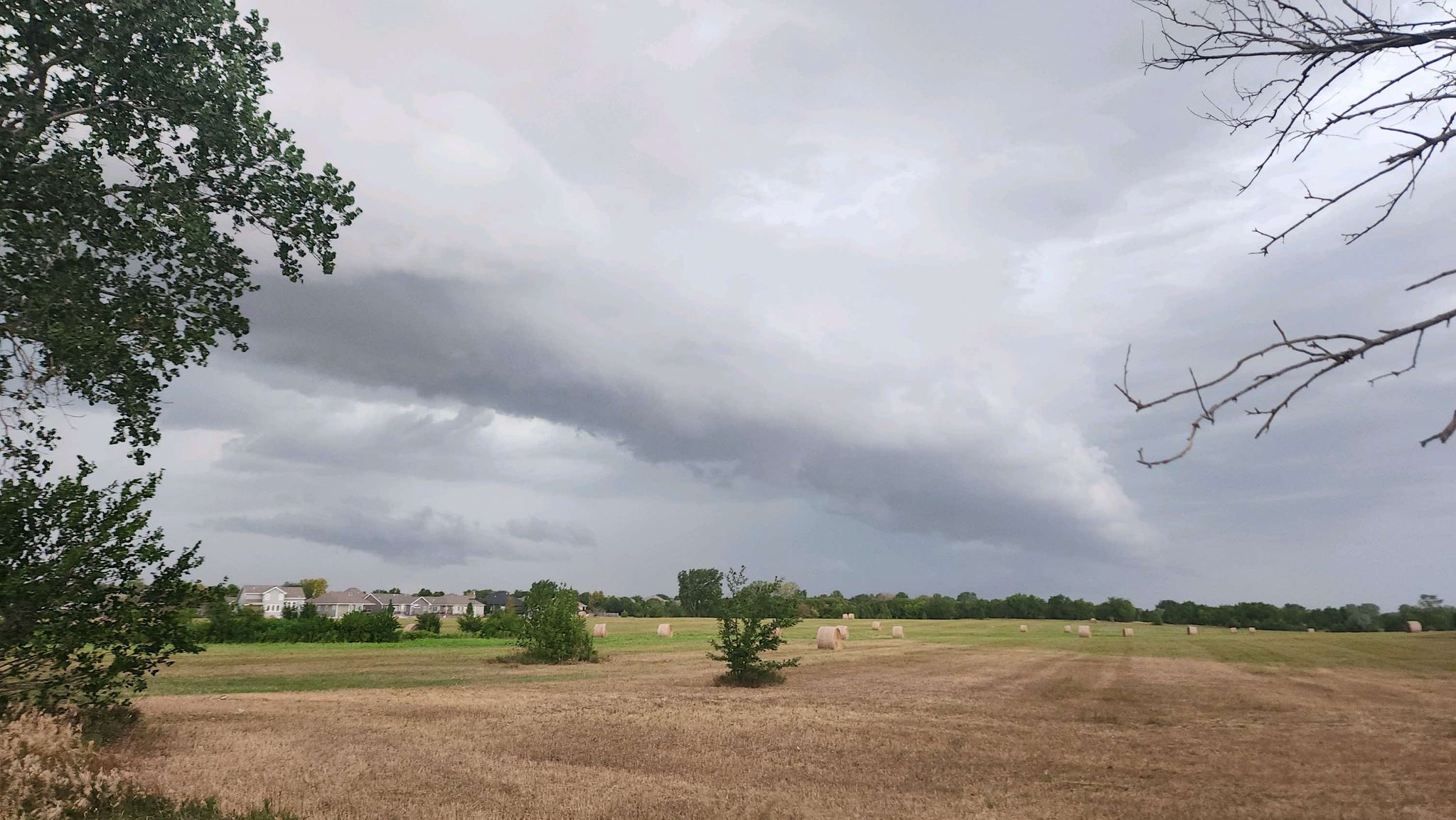
A shelf cloud over east Salina. Photo be David Toelle