After a windy day Tuesday, severe weather will be a possibility by evening.
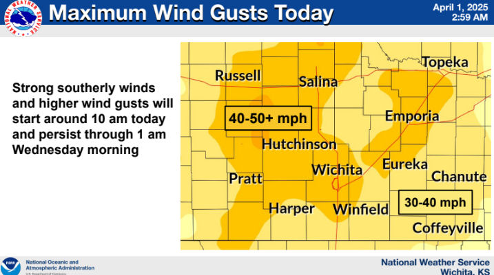
According to the National Weather Service, initially strong southerly winds and higher wind gusts will start around 10 am Tuesday and persist through 1 am Wednesday morning. Across Central Kansas wind could gust in excess of 50 MPH.
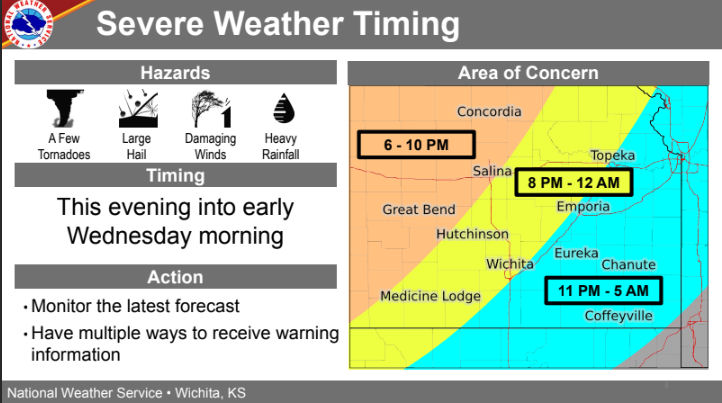
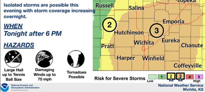
Showers and storms will begin to develop after 6 PM in central Kansas and move to the east and southeast through the evening and overnight hours. Severe storms are likely across a large swath of the area. The strongest storms will be capable of large hail up to tennis ball size, damaging winds up to 70 mph, and a few tornadoes.


