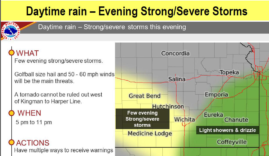
Multiple rounds of severe weather are possible from today through Thursday.
The severe weather potential will begin with a more isolated severe storm chance today, but chances of more widespread severe storms
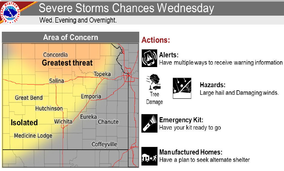
There are again severe storm chances for Wednesday. Most of the severe storm chances will occur on Wednesday evening and Wednesday night. The greatest threat will occur for areas along and north of Interstate 70 as a severe complex of storms moves southeast, with 60 to 70 mph winds. A more isolated severe threat may occur over south central Kansas.
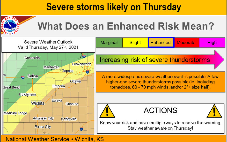
More severe weather is anticipated Thursday. Severe storms will likely develop on Thursday, along a slow moving frontal boundary. The greatest risk of “higher end” severe storms is along and east of the Kansas Turnpike. ALL facets of severe weather are possible including golf ball to tennis ball size hail, 60 -70 mph winds and even a few tornadoes.
_ _ _
CLICK PHOTOS TO ENLARGE
